
You were that crow.
The sun shone as you took to the air from the highest branch of an oak tree. Leaving the village of Irby behind you, you rode the air currents downhill, heading southeast.
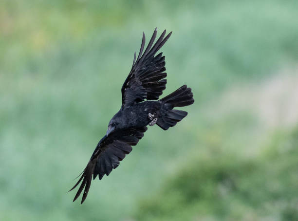
A gentle updraft urged you higher but you resisted, splaying your flight feathers and pitching your tail, preferring instead to fly low, hugging the hill’s familiar contours.
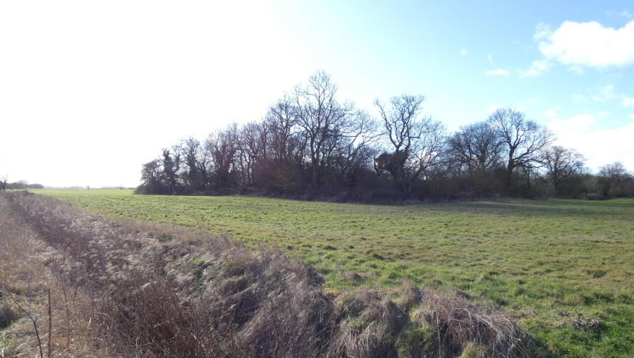
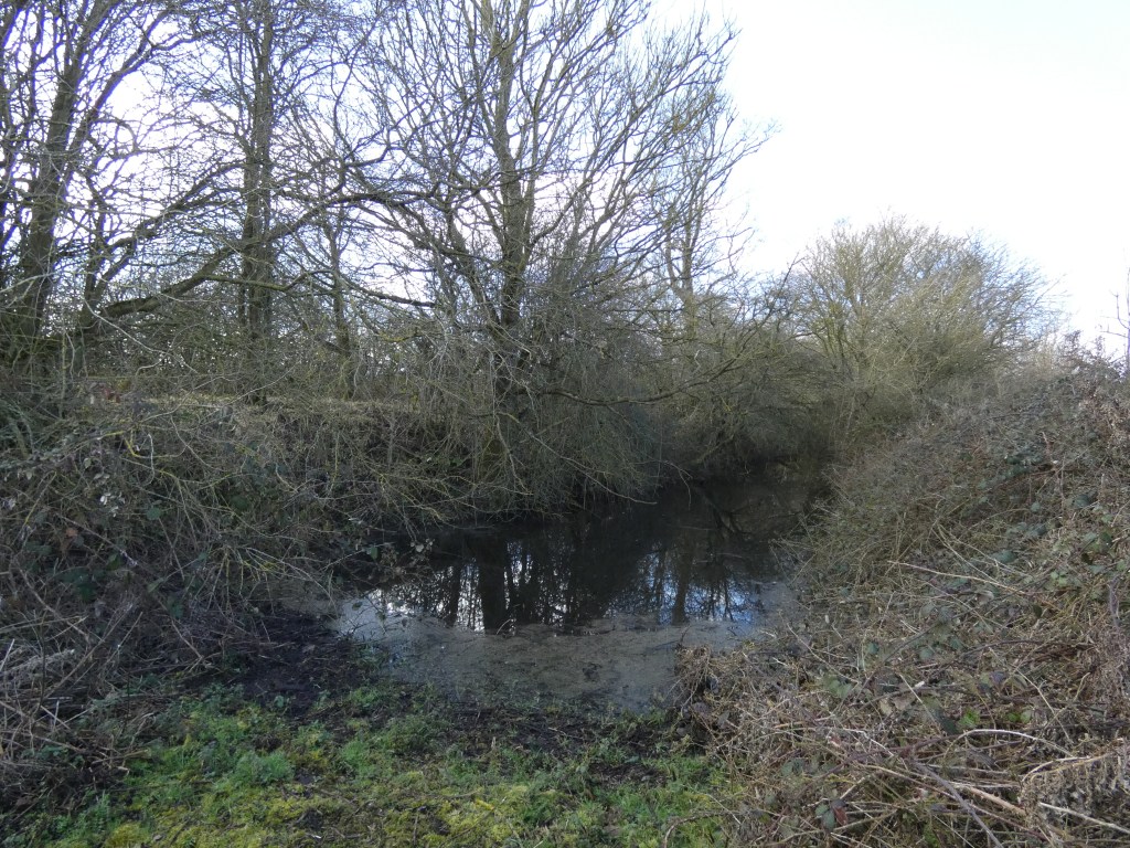
After only a few wingbeats a ragged copse of trees and shrubs loomed up before you.
A place you know very well.
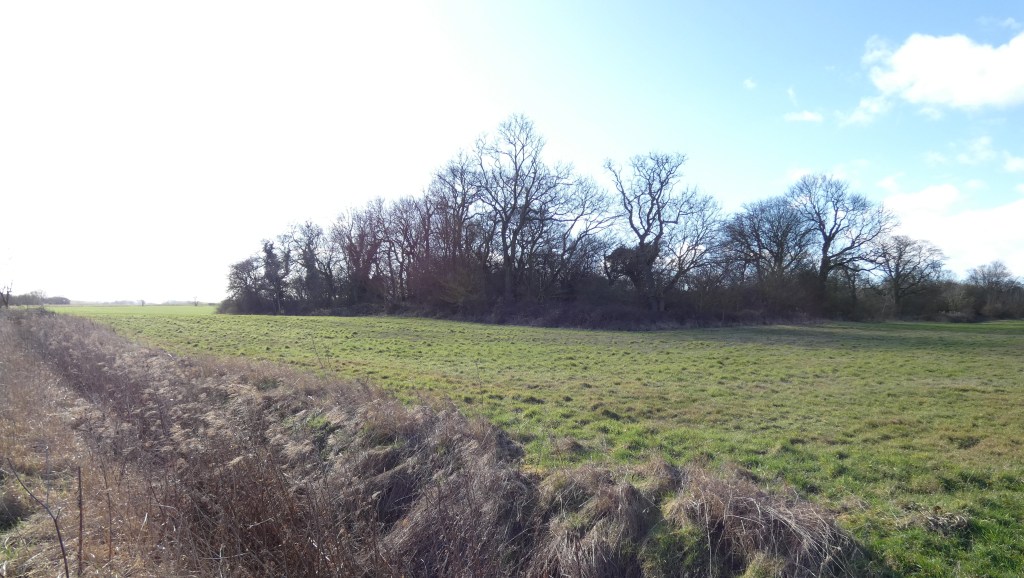
Isolated and untouched by the plough, it’s always a good source of food. Here, too, waterlogged ditches reliably provide year round water.
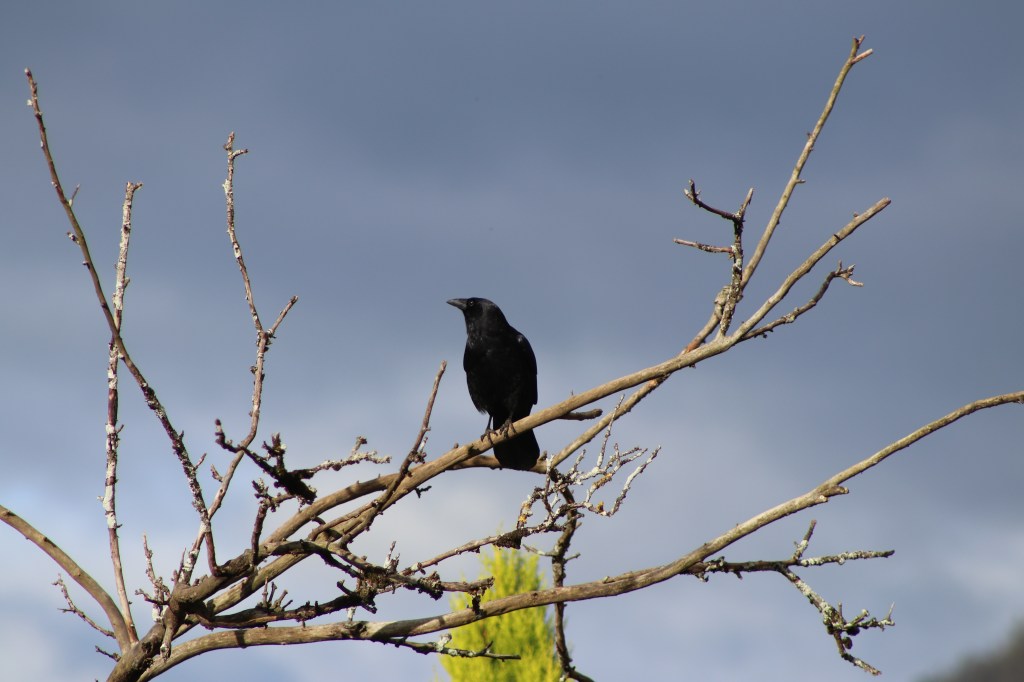
You spotted your favourite perch atop a wizened ash and aimed for it. You flexed your wings, cinched your tail and reached out, landing effortlessly, silently.
From your vantage point you saw below you a small group of walkers skirting the soggy field edge. Curious, you watched as they paused briefly at a deeply-rutted trackway which winds through the weed-grown brushwood. One of the party looked up at you, meeting your gaze. He watched you for a long moment before turning away, to follow the others into the confusion of overgrown entrenchments.
That walker was me.
It had been a sunny February morning and I, along with a few others, had joined James Elliot for our weekly excursion into nature. Previous weeks’ ventures had been fulfilling and this latest outing also promised to deliver.
Our previous walks had been so enjoyable, I’d been moved to write about them on here. First, there were the blow wells at Laceby. Then, we followed that by exploring the ethereal Welbeck Spring.
It was while visiting the spring that James had told us of some nearby earthworks, believed to be from the Civil War. The site was thought to be a little beyond a nearby ridge line. Such was the interest among the group that we decided then to devote a future ramble to exploring the monument.
This we did, as you saw from your perch. The weather was perfect for our visit, and although enjoyable, our exploration did little to explain why this mute, secluded ruin came to be here.
I was ‘volunteered’ to research it.
Once home, I began my investigation by consulting an Ordnance Survey map of the locality.
Sure enough, the earthworks were shown, sited on a hillside half a mile from the Barton Street.
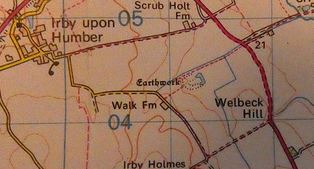
Clearly, the fortification – if that’s what it was – would have commanded a strategic position on this major north-south route.
The map symbol was disappointingly vague. What were those mysterious earthworks? What was their purpose, and who built them? These were all questions to which I was keen to find answers. To begin with I knew very little.
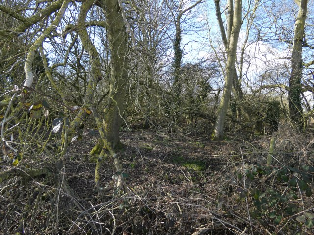
Our foray into the relict had failed to suggest how it may have once looked.
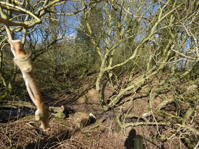
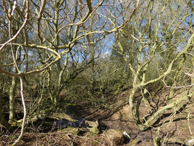
All we had been able to discern at ground level was a muddle of entrenchments among which numerous trees had grown.
These were now set amidst a tangle of brushwood and shrubbery, interwoven with several waterlogged ditches.
As you well know, to gain an idea of the layout, one must take to the air, for only a ‘crow’s-eye view’ reveals the typography of the site. Thankfully, I was able to find aerial photographs, and further research provided some statistical information to support them.
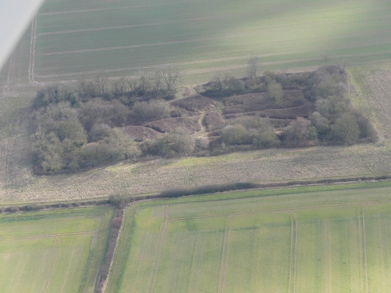
The monument is indeed a 17th century earthwork fort, the situation of which was well-considered. On high ground close to the road connecting the Humber region to the important towns of Boston and Kings Lynn, it was also within easy reach of another main civil war highway, that from Newark to the Humber via Gainsborough.
Originally, the site comprised a rectangular earthen rampart with projecting bastions at each of its four corners. It also had an enclosing ditch, with a counterscarp bank. The area enclosed by the rampart was 130m long, and 50m wide. The surrounding rampart was up to 1.5m high, 6m wide at the base, and between 1m and 1.2m wide at the summit.
The square earthen bastions projecting from each corner of the rampart were between 10m and 12m square, and guns positioned on these bastions would have given covering fire for the ramparts and gateways.
The ditch was 8m wide and up to 2m deep, enclosed by a counterscarp bank of up to 1m high and 3m wide. This bank has since been eroded in places by plough action.
Most notably, the fort is also believed to have enclosed a hall. The fortification of manors was fairly common during the period.
These, then, were the rather bland, technical elements of the monument. Key questions remained, however. One of which was ‘who owned it?’

If you have followed this blog, you will know that Lincolnshire was one of the most heavily-contested regions during the English Civil War. I covered this in my post ‘The Battle of Riby Gap,’ in which told of one local civil war engagement.
We know, too, that the bloody civil conflict which divided a nation, divided families, too. One such family were the Holles, owners of the manor at Irby-upon-Humber.
The family’s name is a familiar one to Grimsby’s residents. It has been honoured in street names, such as Holles Street and Gervase Holles Way. Furthermore, Gervase Holles – or rather a stone sculpture of him – can also be seen glaring down at passers by from Grimsby’s Town Hall.
As with many of our titled families, conflicting views – political and religious – divided them once war was declared and loyalties considered.
Denzil Holles, a prominent MP, commanded Parliamentary troops, while his cousin Gervase, who became MP for Grimsby, was a Royalist, supporting Charles I. Each of the two men made significant contributions to their respective causes during the bitter conflict, both recording illustrious military careers.
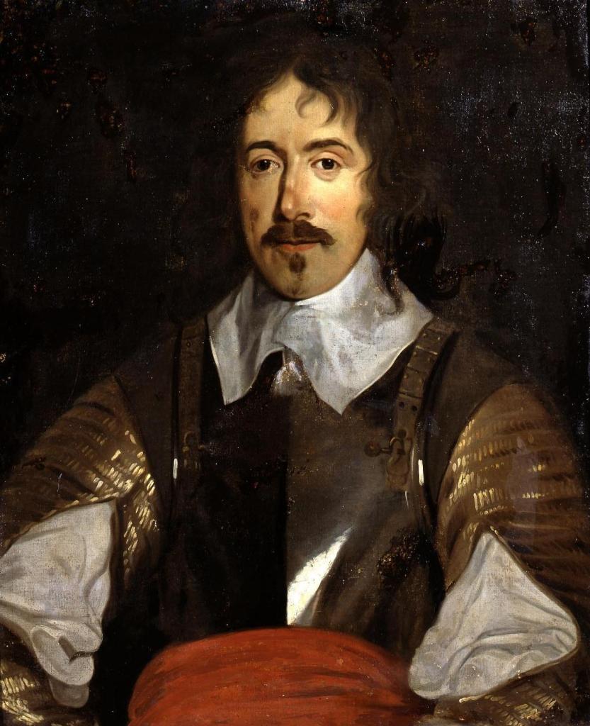
Denzil Holles (1st Baron Holles) is perhaps best remembered as one of the five men whose attempted arrest by King Charles I in January, 1642, sparked the First English Civil War.
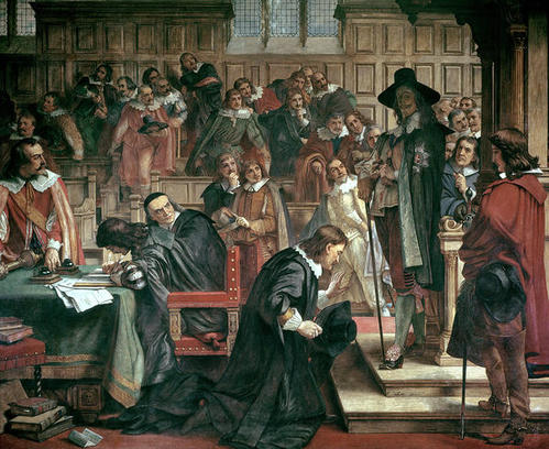
The others were: John Hampden, Arthur Haselrig, John Pym and William Strode.
We know then that the Holles of Irby-upon-Humber, and who also possessed numerous landholdings elsewhere throughout the country, were bitterly divided. But to which of these two warring cousins can we assign the enigmatic earthworks?
As I have said, the battle to control Lincolnshire was fiercely contested throughout the war, more so during the period from late 1642 and through 1643. It was at this time, when the king’s forces controlled much of the county, that they sought to prevent troop movements and the communications flow of Parliamentarians in Hull and Boston.
It is considered likely, therefore, that this monument was built during that time by the king’s forces – in which case we may ascribe the ruin to Gervase Holles.
Was this then the site about which Gervase Holles wrote:
‘… a place happy in the sweetness of the air and very delightful by the pleasant hills and dales, where there are dry and inviting walks both summer and winter, with a welcome prospect towards the sea; affording as good hawking and hunting, and as good conveniency for training and airing young horses, as can be found anywhere.’
With regard to site ownership you may have noted my earlier use of the word ‘may’. For without more in-depth research, I cannot be certain.
However, you – the silent sentinel in the treetop – know full well the answer to that one. After all, haven’t you been here for a very, very long time.

Beautifully written, and a fascinating bit of local history.
LikeLike
Thanks for your kind comments. When writing my blog posts I try to walk the line between ‘creative prose’ and readability. It’s usually a compromise.
And the area’s history interests me.
So, expect to see more of the same in the weeks to come.
LikeLiked by 1 person
I look forward to it! I think you get the balance spot on. It’s very readable but also really lyrical, almost poetic. Lovely.
LikeLike